- Legal Framework (de)
User Tools
Sidebar
Table of Contents
UAVs and Research Groups
Pretty unordered and incomplete, yet.
Flugplattformen
Günstigere Multicopter, Community Lösungen und Bausätze
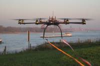
![]() http://mikrokopter.de/ (first Octocopter of HSRW)
http://mikrokopter.de/ (first Octocopter of HSRW)
![]() ArduCopter (open source, good flight planning software ArduPilot)
ArduCopter (open source, good flight planning software ArduPilot)
http://www.electronicarc.com ArduCopter Octo für 570EUR ? (tested by a school in cooperation with HSRW)
http://www.buildyourowndrone.co.uk/
http://unmannedtechshop.co.uk/
http://www.watterott.com/ (nur ArduPilot)
http://www.openhardwarestore.com (nur ArduPilot)
http://www.viperflightsystems.com
Sehr günstiger Multi-WII-Controller
http://myhangar.de/modelle/meine-copter/multi-wii-quadrocopter/
http://modellfluginfo.de/Modellflugzeug/quadrocopter-anleitung.php
muss noch sortiert werden
http://www.cadmicopter.info/ http://uas.maintenancecc.com/index.php?option=com_mcc&act=pdata&task=home http://www.atair.com/insect/
Professionelle Anbieter
![]() http://www.dji-innovations.com/
http://www.dji-innovations.com/
![]() http://mavinci.de/ : Schöner Autopilot für Tragflächenmodelle
http://mavinci.de/ : Schöner Autopilot für Tragflächenmodelle
http://aibotix.de/ : Steuerung über iPad
http://geocopter.nl/ : Turbinengetriebenes, großes Hubschraubermodell
http://www.airrobot.de/ : Professionelle Drohne, Security
http://www.service-drone.com/shop/article/?article=129 : Wärmebildkameras für PV
http://blogingenieria.com/empresas-ingenieria/fulmares-uav-altura/
http://www.bluebird-uav.com/ : Israel, auch militärische Nutzung
http://uav.xenocross.net/xenouav-e.html : aus Japan
Immersionsflug, Fliegen aus der Pilotensicht
![]() http://www.immersionsflug.de/ : First Person View
http://www.immersionsflug.de/ : First Person View
http://www.hobbyking.com/hobbyking/store/__15126__FatShark_5_8Ghz_Telemetry_System_Incl_Tx_Rx_.html
Andere Flugmodelle
Mentor Multiplex
http://www.rc-show.com/de/modelle/flugmodelle/multiplex-mentor/multiplex-mentor.aspx
http://www.rcline.de/modules.php?name=News&file=article&sid=193
Gleitschirm
Zeppelin
Auto Pilot
Open Pilot, Fixed Wing and Multicopter
Motore
Sensoren
Thermografie
http://www.messbar.de/messbar-flightimager-flugfaehige-waermebildkamera-80mk-p-30035.html http://www.messbar.de/pdf/flugdrohne_thermografie.pdf
Themen Projektkurs
Ideensammlung
- Precision Farming - http://www.vandenborneaardappelen.com
- Sensor Fusion by Kalman Filtering (Advanced Signal Processing)
Forschergruppen:
http://projectbioscope.eu/ , EU project with http://terrasphere.nl/ and http://www.aerovision.nl/ (Tamme van der Wal)
Hyperspektrale Fernerkundung
http://rst.gsfc.nasa.gov/ (tutoral)
http://www.ufz.de/index.php?de=17504
 Quantalab, Spanien, Untersuchung von Orangenbäumen durch Drohnen: http://quantalab.ias.csic.es/projects.htm
 Drohnensteuerung über das i phone (Zufunft durch Kommunikation): http://www.zebresel.de/projects/zebresel-air-view/
- Forschungsprojekt von Prof. Dr. Verena Hafner und Prof. Dr. Ruprecht Herbst:
- Remote Sensing
- Harm Bartholomeus (2009): The influence of vegetation cover on the spectroscopic estimation of soil properties, PhD thesis, Wageningen University and Resarch Centre (WUR)
- Laboratory for Research Methods in Quantitative Remote Sensing (QuantaLab) at Consejo Superior de Investigaciones Cientificas, Spain
- Berni, J.A.J., Zarco-Tejada, P.J., Suarez, L., Fereres, E. (2009): Thermal and Narrow-band Multispectral Remote Sensing for Vegetation Monitoring from an Unmanned Aerial Vehicle. IEEE Transactions on Geoscience and Remote Sensing, 47, (3), 722-738. pdf

